It’s time to lay down our trowels on the National Highways A14 Cambridgeshire to Huntingdon road improvement scheme. After nine years, we’ve sieved every soil sample, examined every pottery sherd, and catalogued every find.
Now, we’re delighted to celebrate the many and varied outputs of the project, including the recent publication of our A14 monograph: Time Travellers’ tales; essays from the A14 Cambridge to Huntingdon archaeological excavations - which is available to buy in the MOLA online bookstore. Read all about fascinating themes we’ve uncovered through our research and the debates we’ve had about our discoveries.
This is complemented by our free open-access Internet Archaeology monograph. Each chapter tackles a different period in the A14's past, linking back to our incredibly detailed site and specialist reports. You can read those too - find all reports from the project in our digital archive hosted by the Archaeology Data Service (ADS).
We’ve also just delivered learning boxes to 25 local schools. These contain 3D printed copies of some of our favourite finds from the dig, as well as real pottery, animal bone, and ancient building material from the excavations. These all tie into our series of activities, which include everything from a Roman-style snakes and ladders game to early medieval weaving, designing an ancient settlement, and our great medieval debate. We wanted to share the fun (and learning!) with everyone, so click here to download all the resources from the pack to try yourselves – they're aimed at kids aged 7-11, but big kids can have a go too!
If that wasn’t enough, here’s our final blog. To celebrate the end of this incredible project, we’ve rounded up nine fascinating things we’ve learnt from the A14 excavations - and where you can find out even more about them. You’ll also find a full list of all our A14 outputs at the end of this blog. Of course, none of this would have been possible without the hundreds of people who have worked on the project over the past 9 years. A huge thank you to everyone involved!
1. Rural Roman Cambridgeshire was incredibly well connected
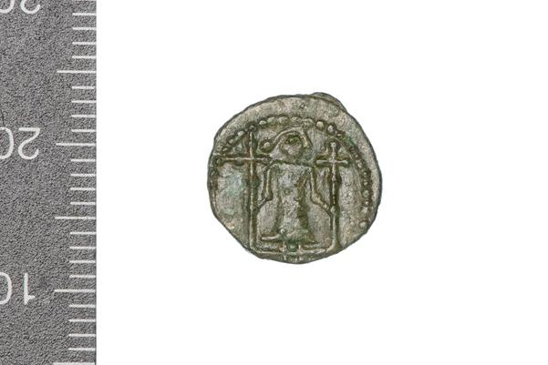
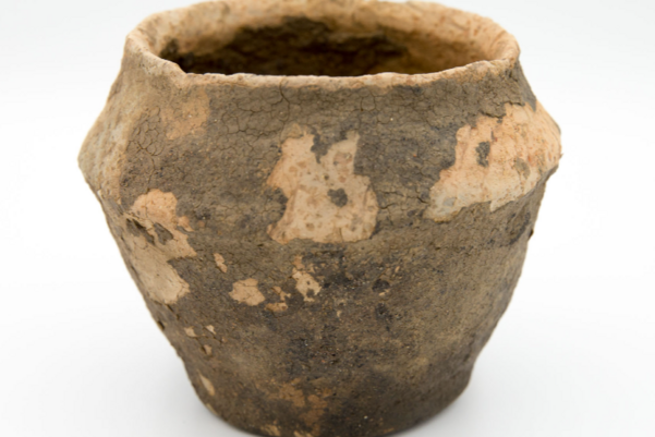
Objects uncovered during our excavations, including Samian ware from Gaul, quern stones from Hertfordshire and Germany, and almost 1000 Roman coins, show that local communities were part of a thriving trade network.
A discovery made during aDNA analysis of one burial showed these connections stretched to the very edge of the Roman Empire. Specialists from Durham University and the Francis Crick Institute uncovered evidence that a young man buried in an isolated grave near Offord Cluny was born thousands of miles away in an area which is now southern Russia, Armenia, and Ukraine.
In the Roman period, this area was home to a nomadic group called the Sarmatians. This is the first time anyone has identified someone with this genetic profile in Roman Britain.
2. What stone tools can tell us about prehistoric lives
The discovery of more than 5000 flint tools opened our eyes to an ancient landscape, dating from the early Mesolithic (10,000-4,000 BC) to the Bronze Age (2500-750 BC).
These fragments of worked stone are often our only evidence for the lives of people who roamed this area many thousands of years ago in the Mesolithic period. They suggest there may have been a ‘base camp’ on the edge of the River Great Ouse. This would have been a great location with easy access to water and other resources. The community may have lived there permanently or seasonally, as they travelled to find the best places to hunt, fish, or harvest wild food.
Find out more
Find out how flints were used in other time periods in our Stone tools blog
3. We uncovered missing pieces in Cambridgeshire’s early medieval puzzle
Half a mile from the modern village of Conington, our excavations uncovered an early medieval settlement with potentially royal connections. The name ‘Conington’ means ‘King’s enclosure’ or ‘estate’ (cyninges-tun in Old English).
The settlement, which dates to around AD 600-800, stood on a gravel ridge. This gave the community a great vantage point over the surrounding area. There was also a defensive ditch and imposing entry gate. Conington sat on the boundary between two middle Anglian kingdoms: West Willa and Herstingas, before whole area became part of the Mercian kingdom. We think the settlement became a Mercian administrative centre. This would explain why it was abandoned in the early 800s, as this is when Mercia began to lose power.
Nearby in Brampton were even more clues to the area’s early medieval past. We uncovered the remains of a previously unknown village, dating from AD 700 all the way into the medieval period (1066-1485). After we finished excavating, our plan of the site revealed details including winding alleyways between houses, workshops, and farm buildings.
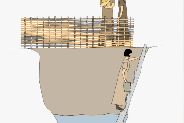
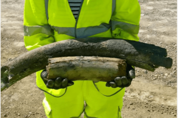
Wood has always been a hugely important material for making fires, buildings, and other everyday objects. It is incredibly rare to find wooden objects during archaeological excavations. However, we struck gold (or rather wood!) excavating an Iron Age settlement near Fenstanton, where a wooden ladder was still standing in place, leading down into a watering hole. The damp conditions had perfectly preserved it for more than 2500 years.
Along with water, a key location for ancient settlements was close to woodlands. The medieval village of Houghton had prime position by Brampton Wood, however, this luck didn’t last. In 1154 King Henry II claimed the whole county of Huntingdonshire as his exclusive hunting ground. As the ‘royal forest’ expanded, the villagers lost access to the local woodlands which would have provided their food, fuel, building materials, and some of their jobs. They couldn’t afford to stay in Houghton without these resources and eventually deserted the village.
When excavating our high-status Roman estate near the River Great Ouse, we didn’t find much evidence for most stereotypical Roman foods. We only uncovered a few fig seeds, one olive stone, and one grape pip. However, other finds from across the A14 could point towards what food our Roman residents might have been enjoying.
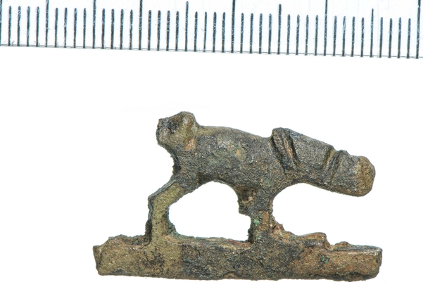
Nearby we discovered the remains of a peregrine falcon. Could this be the remains of a bird used for hunting? When we examined other animal remains from the dig, we found there was an increase in wild boar, while a knife handle showing a dog hunting a hare shows hunting was a popular Roman past-time. A barbed javelin found near Brampton could also be evidence for hunting during the Roman period.
Archaeologists often know what archaeology we might find during our excavations, because we carry out surveys of the area before we start digging. This includes researching past discoveries in the area, trial trenching, and using geophysics to take a look under the ground without lifting a spade.
However, there are always surprises, and the A14 had more than a few exciting secrets waiting to be discovered.
7. What pollen tells us about Cambridgeshire’s ancient landscape
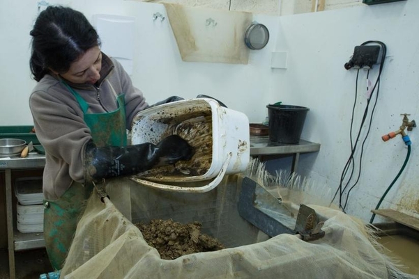
As part of our work, we took over 9000 samples for our specialist environmental archaeologists to examine. The results of their analysis tell us about the plants and trees growing across the whole A14 scheme from the Bronze Age (2500 BC – 750 BC) to the Early Medieval period (410 AD – 1066). One of our incredible discoveries is that Brampton Woods are 3000 years older than we thought!
Now we know what natural resources people had, such as types of wood and what crops they grew, we can understand more about what it was like to live in this landscape. Different plants like different conditions, so we can use this information to reconstruct the environment of the A14 through time - including the weather!
8. Sometimes our discoveries leave us with questions as well as answers
We uncovered Bronze Age cemeteries, burials, and incredible monuments – including a previously unknown timber circle. Finds from these sites included wealthy grave goods such as the remains of an amber necklace. We also found arrowheads from the early Bronze Age, which suggests people continued hunting for food, as well as farming and keeping animals.
But where were the Bronze Age settlements? The more evidence we discovered of ritual and burial, the more questions we had about the Bronze Age world of the living along the A14.
9. Excavating an entire landscape gives you an incredible window into the past
One of the best parts of the A14 scheme was getting to uncover an entire landscape and explore how it changed across thousands of years of prehistory and history. We didn’t just see the impact of human activity on the land, but how natural resources influenced the areas people chose to live and work in, the materials they had, and how connected the many settlements were – both with each other and the wider world.
The archaeological programme for the Cambridge to Huntingdon National Highways scheme was carried out by A14 Integrated Delivery Team on behalf of National Highways. Find out more about the A14C2H improvement scheme.